 Margen
Did you know? · From the Margen catalogue
Surtsey is closed so that not even one seed gets in
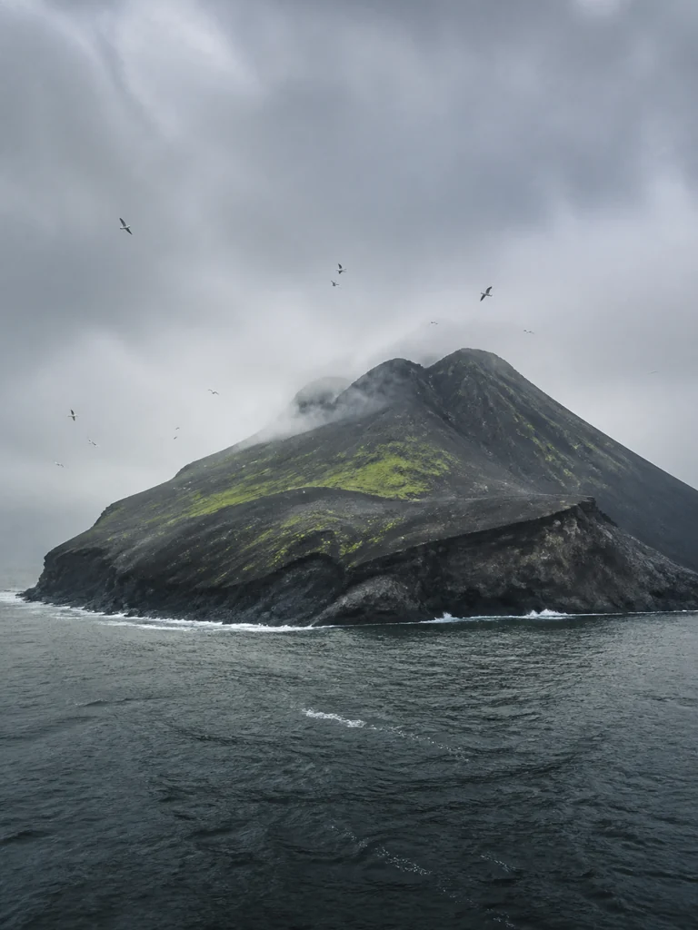
14 November 1963. A fishing boat spots a black column south of Iceland. The eruption has begun at a depth of about 130 metres, piling up ash and lava until it reaches the surface that same day. Surtsey is born with no old soil, vegetation or land animals, giving scientists a starting point they can date almost hour by hour. By 15 November, the new island is already about 500 metres long and between 40 and 45 metres high.
1964. The first expeditions record shoreline organisms, floating seeds and others carried by birds. Researchers count specimens, photograph the terrain and collect samples to determine how each species arrives.
19 May 1965. Iceland places Surtsey under protection while the eruption is still under way. Landing is allowed only with permission, and bringing in animals, plants, seeds, soil or waste is forbidden. Equipment is inspected before anyone steps ashore, because a seed stuck to a boot could germinate, be recorded as a natural arrival and distort observations maintained over decades.
5 June 1967. The eruption ends. Syrtlingur and Jólnir, the neighbouring volcanic islets, will eventually disappear beneath the waves; Surtsey retains a core of lava and palagonite tuff (volcanic ash that water helps consolidate and harden). From this date onwards, each expedition must also measure the erosion of a coast newly added to the maps.
Summer 1969. Ágúst Bjarnason, the botanist responsible for monitoring the plants, finds a tomato plant about fifteen centimetres tall. It has sprouted from poorly managed human excrement. He pulls it out, puts it in a plastic bag and carries it away before it can affect the counts. Bjarnason keeps the episode private for 45 years, but the intervention exposes the fragility of the record: a single foreign plant can be wrongly attributed to the island’s colonisation.
1989. Expeditions in the late 1980s already show the effect of the gull colonies. Nests and nutrients supplied by the birds enrich the soil, producing dense patches of vegetation around those areas; on exposed ground, wind and salt slow the spread. Authorised visits follow limited routes and every sample leaves counted and labelled, so photographs repeatedly taken from the same points can be used to compare changes originating on the island.
July 2008. UNESCO adds Surtsey to the World Heritage List during the 32nd session of its committee, held in Quebec. The protected zone covers 3,370 hectares because it also includes the seabed surrounding the island, an area far larger than the land above water. The listing recognises an ecological process observed from its birth and preserved for more than four decades through permits, restricted routes and a site closed to the public.
2015. The vascular-plant record reaches fifty years; these species carry water and nutrients through internal tissues. Field sheets from the earliest expeditions are compared with recent images of the same slopes. Biologists reconstruct soil formation and connect vegetation with fauna, while geologists measure erosion, underground heat and the changes water produces in volcanic materials.
2026. The Environment Agency of Iceland, Umhverfisstofnun, manages the reserve, and the Surtsey Research Society organises the scientific expeditions. Photographs and 3D models make it possible to examine the coast and vegetation without increasing the number of landings. Surtsey is one of the few places on the planet where the origin of every species recorded since 1964 can be reconstructed. The sea has already taken half of the maximum area Surtsey reached in 1967.